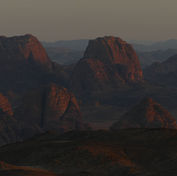
Hejaz Hills
One of the great mountain ranges of the Middle East, the Hejaz are a chain of towering peaks that form part of a bigger upland stretching the length of Arabia's Red Sea coast, from Aqaba in the north to Yemen in the south. It was in these mountains the story of Islam began nearly 1500 years ago and the holy towns of Medina and Mecca stand in their heartlands today. Once one of the grand old provinces of Arabia, the Hejaz remains a region with a firm sense of its own identity and it represents the historic homeland of Bedouin tribes who settled everywhere from Lebanon, Syria and Palestine to Egypt and the Atlantic coasts of North Africa, carrying their culture, faith and language to shape the Middle East into the region it is today. Whilst Wadi Rum represents the northernmost fringes of an area called the Hisma - a vast desert of towering sandstone massifs and sweeping red dunes - the granite hills on Wadi Rum's western margins are, geologically, a part of the Hejaz. This is an area of open grey hillsides, ridges and granite crags, crisscrossed with black and maroon dykes, representing some of the most varied scenery on the trail. Its high elevation gives it spectacular panoramas over the sandstone massifs of Wadi Rum to the east; to the west, the jagged peaks of the Hejaz line the horizon. The 'Wild West' of the Wadi Rum Trail, this area is seldom-visited and has a quiet, serene feeling throughout. Hikers will enter this region after moving out of Wadi Saabit on the seventh day. The true hills of the Hejaz are reached around Jebel Abu Baytherana, usually mid-way through the eighth day. Jebel Rum's magnificent sandstone heights come into clear view from here, representing the final challenge for hikers and it is to their traverse the last two days of the trail are devoted.


Trail Highlights
Jebel Thathaa

The Wadi Rum Trail enters this region by crossing Jebel Thathaa; a tract of low sandstone hills that divide the sweeping spaces of Wadi Saabit from Wadi Swaybit; its smaller sister wadi to the north. Wadi Swaybit literally means the 'little' Wadi Saabit in Arabic. This is a sandstone area with red dunes - similar in hue to those around the main course of Wadi Rum - and one of the prettiest parts of the trail. Ancient graffiti depicting camel hunts and tribal signs is found on rocks and in some areas the small branches Bedouin honey-makers once wedged in cracks as climbing aids to reach hives on high ledges are seen too. After crossing Wadi Swaybit the trail traverses the massif of El Qiddar.
Jebel Abu Baytherana

Jebel Abu Baytherana represents a geological oddity on the Wadi Rum Trail; a region of light coloured granite hills in a mostly red sandstone desert. Granite hills of this kind are buried below the whole region but in only a few places are they exposed at the surface. They are at least 500 million years older than the sandstone - which formed on top of them in more recent geological eras - and mark some of the northernmost extents of the Hejaz. The Wadi Rum Trail runs over the high hills of Jebel Abu Baytherana - where spectacular far-reaching views extend over Wadi Rum's majestic sandstone heartlands before making the final approach to Jebel Rum, below which camp is made on the eighth day.
El Qiddar

El Qiddar is a high massif whose domed summit towers up over the remote deserts south of Wadi Rum. Its southernmost end is split by a shadowy chasm known as Raqaba El Qiddar, which offers a dramatic natural walking passageway west towards the pretty course of Wadi Um Ghatha. Bedouin shepherds once drove their herds this way and the small stones they placed in cracks to help goats on the crags can still be used as makeshift steps. After Wadi Um Ghatha hikers pass Haraab Anter, where two, large natural caves are found, before continuing to the foot of Jebel Mirrowah. This is the lowest point on the Wadi Rum Trail and camp is usually made here on the seventh night.
Other highlights & routes

Alongside hidden historical gems such as petroglyphs, Nabataean dams and old burial sites, this region is home to remote, little-trodden massifs, of which the most beautiful is Jebel Gattar. A place of dripping springs and rare wildlife, Jebel Gattar is a realm of quiet wadis, desolate basins and lonely highlands that has a special protected status in Wadi Rum and which remains closed to the public. North of Jebel Abu Baytherana an important secondary route connects the Wadi Rum Trail with the Gulf of Aqaba. A nearly 50km route it takes two days to walk and is best done as an alternative end to the Wadi Rum Trail with hikers following it to the sea instead of climbing Jebel Rum.
%20copy.jpg)
